See Fort McMurray before and after wildfire
By Esri Canada
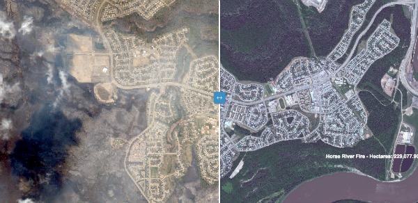
Headlines NewsMay 20, 2016 - Esri Canada has released this Alberta Wildfires Swipe Map that uses satellite imagery taken before and after the wildfire that swept through Fort McMurray, Alta., in May 2016, showing the path and extent of the devastation it has caused.
” frameborder=”0″ allowfullscreen>
Print this page
Advertisement
Stories continue below
Related